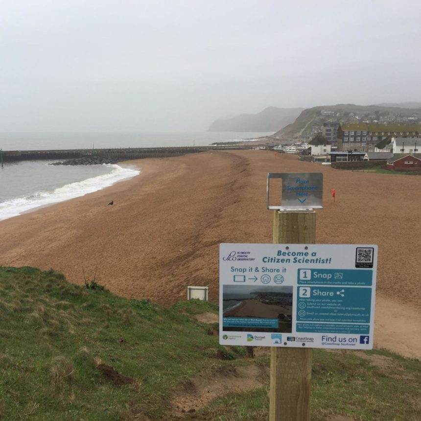


Dorset Council has installed two ‘CoastSnap’ points at West Bay and is now asking people walking past to take pictures there.
The CoastSnap points feature special smart phone cradles that point in a particular direction. This means images taken there can be used to monitor Dorset’s dynamic coastline.
Cllr Ray Bryan, Dorset Council Portfolio Holder for Environment, Travel and Highways, said: “This is an interesting project which anyone with a smartphone can get involved in.
“We are asking people walking by to take a quick snap, using the special smart phone CoastSnap cradle. I hope there will be some ‘Citizen Scientists’ out there who will be keen to help monitor Dorset’s ever-changing coastline.”
Dorset Council is working on this project with Plymouth Coastal Observatory, who will use the images to monitor ongoing coastal changes. The phone cradles mean the exact same image will be taken each time so they can be used to accurately identify coastal changes.
More than a dozen photos have already been submitted and the points were only installed last week.
Any photos taken at the CoastSnap points will help record the status of the beaches. Dorset’s beaches are constantly changing due to tides, weather and erosion.
All photo-senders will remain anonymous. If you send in a photo please note the time and the date it was taken.
Please email photos taken at the CoastSnap points to the Plymouth Coastal Observatory. The address, available at the CoastSnap points, is: coastal.observatory@plymouth.ac.uk
For more information please visit: southwestcoastalmonitoring.org/coastsnap-home