


Dorset is braced for heavy weather and potential flooding over the next 24 hours.
The Met Office has a yellow warning in place for wind for Saturday with wind speeds approaching 40mph. On top of the showers we have seen today (Friday) there are also heavy showers forecast across Saturday.
There are also a number of flood alerts and warnings in place.
FLOOD WARNINGS.
PRESTON BEACH – Large and powerful waves are expected to affect the foreshore, shingle and spray may overtop sea defences. The time and date of the forecast high water is 09:30 on 02/11/2019. The forecast tide level is 1.83 m AOD. The forecast wind strength and direction is Force 9 West South West. Flooding to roads possible at this time however conditions may apply one to two hours either side of the high tide. We believe there is a possibility of flooding for The Sea Life Centre and the Preston Beach Road area of Lodmoor.
WEST BAY HARBOUR – Large and powerful waves are expected to affect the foreshore as a result of high tides and strong winds, this will produce sea spray that may overtop sea defences. The time and date of the forecast high water is 08:15 on 02/11/2019 conditions may apply one to two hours either side of the high tide. The forecast tide level is 2.17 m AOD. The forecast wind strength and direction is Force 10 West South West. Strong onshore winds will cause tide levels to rise further.
FLOOD ALERTS.
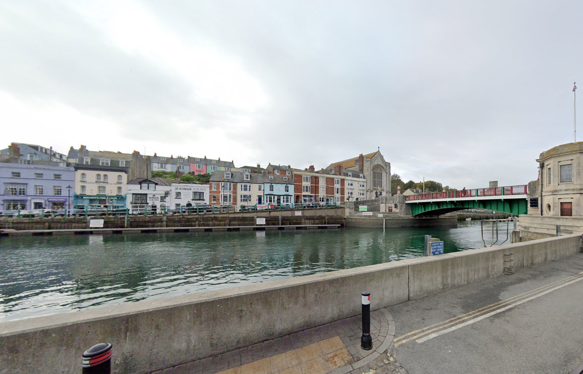
WEYMOUTH HARBOUR – Sea spray overtopping is forecast as a result of strong onshore winds. The time and date of the forecast high water is 09:30 on 02/11/2019. The forecast tide level is 1.83 m AOD. The forecast wind strength and direction is Force 9 West South West. Flooding to roads and footpaths is possible at these times, however conditions may apply one to two hours either side of the high tide. We believe there is a possibility of flooding for Weymouth Harbour and the tidal stretch of the River Wey.
WEST COAST OF DORSET – Very high waves are expected to affect the foreshore as a result of strong onshore winds. Consequently, flooding is possible for the duration of the morning, between 08:00 on 02/11/19 and 11:00 on 02/11/19. Areas most at risk are Lyme Regis, Charmouth, Seatown, West Bay, Bothenhampton, Freshwater, Burton Bradstock, Cogdean Beach, Chesil Beach, West Fleet, East Fleet and Chiswell. Continuing strong winds will cause additional wave overtopping throughout the morning between Lyme Regis & Portland.
The environment agency incident response staff are checking defences and liaising with emergency services. Please stay away from large waves and the foot of cliffs as they are dangerous. They are continuing to monitor the situation.
For more information, visit: flood-warning-information.service.gov.uk/warnings
